AIA Honor Award for Regional and Urban Design 2014
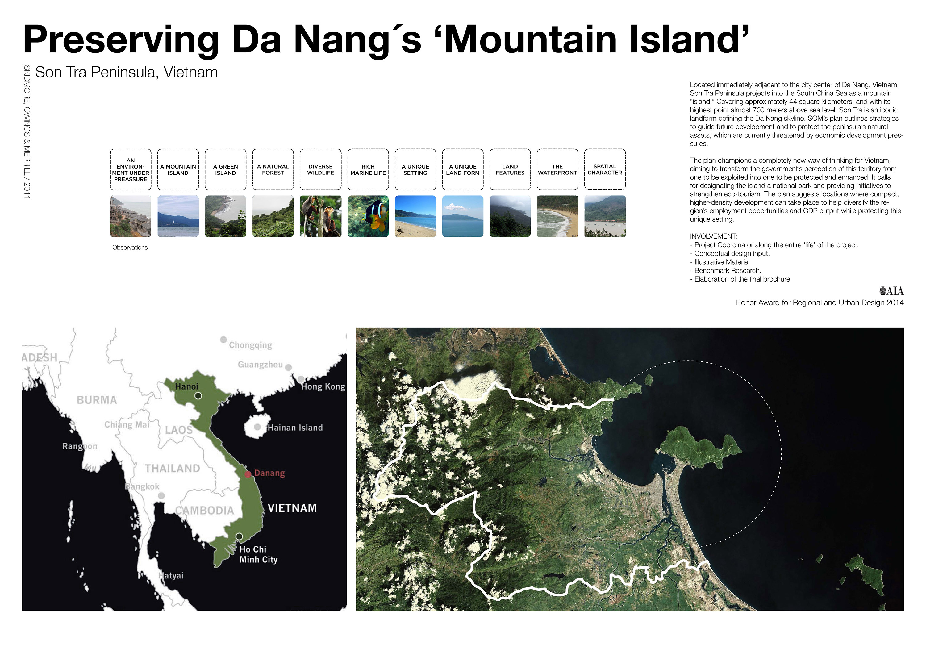
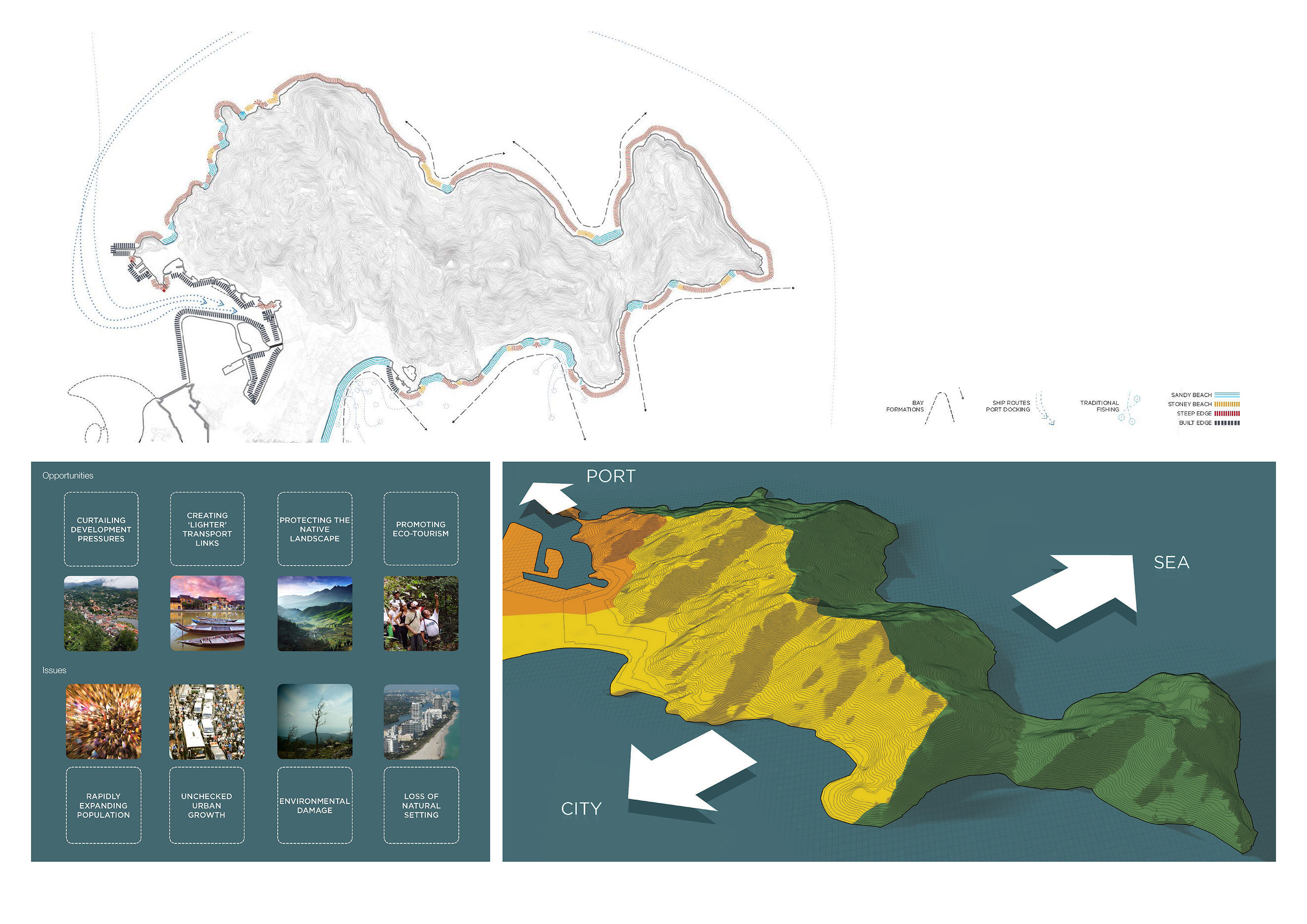
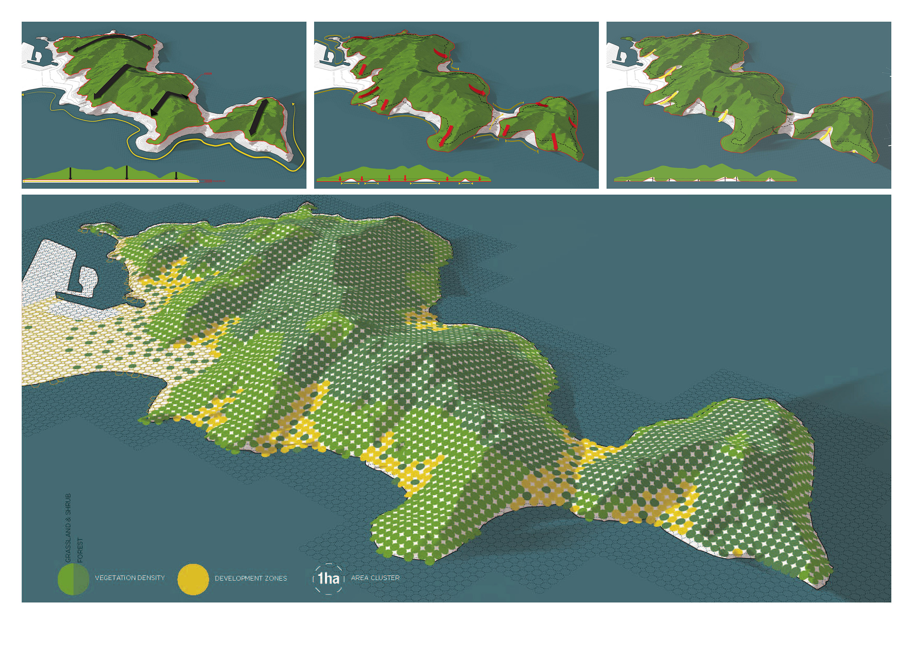
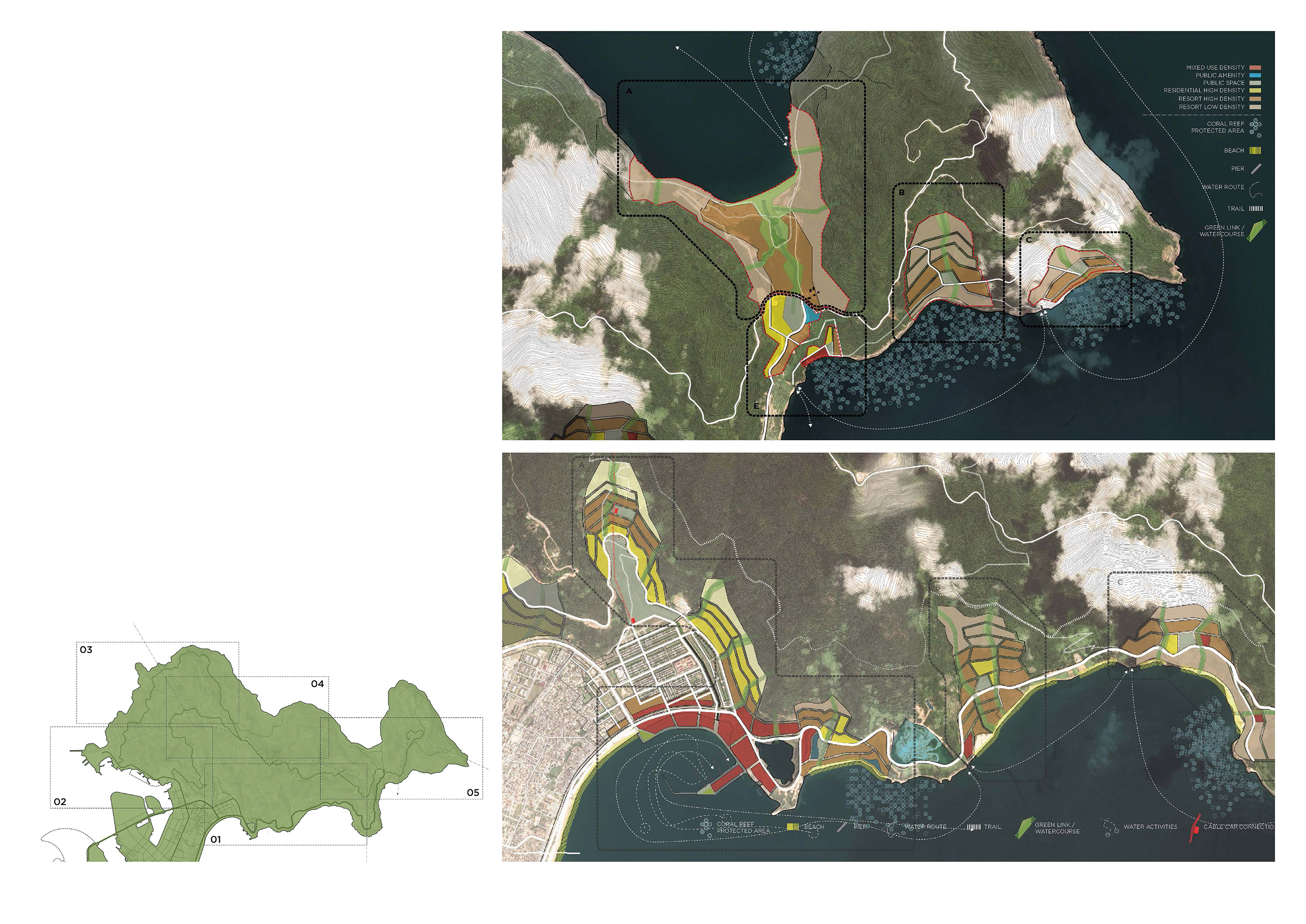
Located immediately adjacent to the city center of Da Nang, Vietnam, Son Tra Peninsula projects into the South China Sea as a mountain “island.” Covering approximately 44 square kilometers, and with its highest point almost 700 meters above sea level, Son Tra is an iconic landform defining the Da Nang skyline. SOM’s plan outlines strategies to guide future development and to protect the peninsula’s natural assets, which are currently threatened by economic development pressures. The plan champions a completely new way of thinking for Vietnam, aiming to transform the government’s perception of this territory from one to be exploited into one to be protected and enhanced. It calls for designating the island a national park and providing initiatives to strengthen eco-tourism. The plan suggests locations where compact, higher-density development can take place to help diversify the region’s employment opportunities and GDP output while protecting this unique setting.
- Date: 2013
- Context: Skidmore, Owings & Merrill
- Category: Urban Design